Tilt photography is an important means of geographic information collection. The UAV is equipped with a high-pixel visible light camera and an automatic flight task to complete the data acquisition required for 3D modeling. However, the current mainstream tilt photography solutions on the market are mostly five-camera and dual-camera solutions. Such devices are often expensive and require large drones as platforms to perform tasks, portability, ease of use, and cost. None of them can be tolerated by the general unit. To this end, Shanghai Bo Lei Intelligent Technology Co., Ltd. (hereinafter referred to as Bo Lei) launched the "single camera and double flight route" method to complete the tilt photography service.
Relative camera tilt photography has the following advantages:
1) The traditional five-camera tilt photography solution usually has a relatively expensive camera module, and the mobile 100,000 or even higher investment is required. In addition, the multi-rotor drone equipped with a five-camera lens has good stability and endurance. Therefore, the hardware cost of the entire flight is quite high. The four-rotor UAV developed by Boerra has a low cost for a single-camera tilt photography solution, which is only one-tenth of the five-camera solution, which greatly reduces the cost of flight.
2) In addition, the M3 quadrotor UAV developed by Boer based on the core components of DJI has a single-camera single-cell battery that can operate for up to 30 minutes, and the work efficiency is not lost to the five-camera solution.
This time, the company successfully completed the tilting photography project of the three-square-kilometer port terminal freight center with the M3 equipped with a single high-pixel camera. The whole project took a short time, and the engineers easily completed the collection of field data.
The specific operation process is as follows:
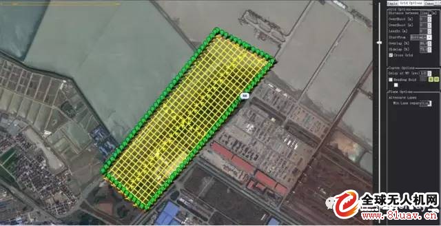
Route planning: through the radar station ground station planning software Captain, map downloading, positioning, route planning for the areas that need to be inspected, and set the corresponding overlap parameter according to the focal length, flight height and project requirements of the sensor lens.

Illustration: Ground station
Field data collection: After completing the route planning, the aircraft and ground stations will be effectively communicated and avoid possible interference signals. After take-off, it will fly according to the preset route, and always pay attention to the flight state of the aircraft feedback from the ground monitor to ensure the accuracy of the flight.

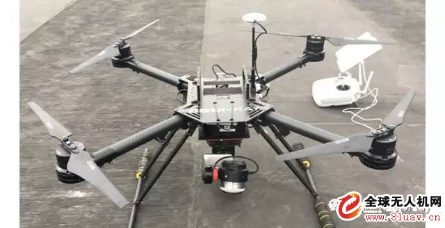
Bo Lei M3 quadrotor drone with single lens
Relative camera tilt photography has the following advantages:
1) The traditional five-camera tilt photography solution usually has a relatively expensive camera module, and the mobile 100,000 or even higher investment is required. In addition, the multi-rotor drone equipped with a five-camera lens has good stability and endurance. Therefore, the hardware cost of the entire flight is quite high. The four-rotor UAV developed by Boerra has a low cost for a single-camera tilt photography solution, which is only one-tenth of the five-camera solution, which greatly reduces the cost of flight.
2) In addition, the M3 quadrotor UAV developed by Boer based on the core components of DJI has a single-camera single-cell battery that can operate for up to 30 minutes, and the work efficiency is not lost to the five-camera solution.
This time, the company successfully completed the tilting photography project of the three-square-kilometer port terminal freight center with the M3 equipped with a single high-pixel camera. The whole project took a short time, and the engineers easily completed the collection of field data.
The specific operation process is as follows:
Route planning: through the radar station ground station planning software Captain, map downloading, positioning, route planning for the areas that need to be inspected, and set the corresponding overlap parameter according to the focal length, flight height and project requirements of the sensor lens.

Illustration: Ground station
Field data collection: After completing the route planning, the aircraft and ground stations will be effectively communicated and avoid possible interference signals. After take-off, it will fly according to the preset route, and always pay attention to the flight state of the aircraft feedback from the ground monitor to ensure the accuracy of the flight.

Bo Lei M3 quadrotor drone with single lens
Core Alignment Fusion Splicer,Digital Core Alignment Fusion Splicer,Manual Fusion Splicer,Precision Alignment Fusion Splicer
Guangdong Tumtec Communication Technology Co., Ltd , https://www.gdtumtec.com